A Match made in Space – Synergies between Galileo and Copernicus

Copernicus and Galileo have already individually helped users to generate substantial added value, however, taken together, they can be combined perfectly to create synergies that not only benefit the EU space ecosystem, but every user across the globe. Since Asia represents one of the largest GNSS users bases and is even forecast to grow by more than 12% each year, synergy exploitation can be expected to have a great benefit.
As both satellite services serve different needs in similar domains, it seems only natural to leverage synergy opportunities. The main application areas which will be discussed in further detail include Agriculture, Urban Planning and Smart Mobility. Whether it is supporting reaching sustainability goals, increasing efficiency for farmers, or aiding in the shaping of smart cities, Copernicus and Galileo based applications can do it all. In order to encourage the innovation of even more clever solutions for the world, the CASSINI programme will support space-based entrepreneurs and foster innovation in the satellite domain.
What are Galileo and Copernicus?
As Europe’s civilian global satellite navigation system (GNSS), Galileo allows users to know their exact position and time with great accuracy. Since going live in 2016, 24 out of 30 final satellites have been launched into orbit and are available to support applications with positioning, navigation and timing services.
Copernicus is the European Earth Observation programme, previously known as GMES (Global Monitoring for Environment and Security). It offers near-real-time data through satellite and in-situ observations and is served by a set of dedicated satellites (the Sentinel families) as well as contributing missions (existing commercial and public satellites).
How do they create Synergies?
Although Copernicus and Galileo have very different data outputs and target different needs, combining them in applications can create some serious synergies. Since all Earth observations have to be geo-referenced and precisely time-tagged, GNSS is already used naturally for in-situ observations. However, there is much more to be gained from combining their data.
Earth observation (EO) enables a prompt generation of large-scale and small-scale maps that include geophysical as well as dynamic parameters. Therefore, Copernicus is analysing and providing the characteristics of a region while Galileo is providing the navigation, support for the high accuracy positioning and tracking of particular targets.
The large amounts of applications are especially visible in agriculture, urban planning, smart mobility and environmental management domains. The synergies between the two are especially suited to help Europe to achieve its twin digital and green transition that entails a new industrial strategy targeted to strengthen Europe’s position on the global market.
Agriculture
The benefits of leveraging the synergies between Copernicus and Galileo become distinctly apparent when looking at the agriculture sector. In 2018, agriculture accounted for 4% of the global gross domestic product (GDP) and in some developing countries, it can account for more than 25% of the GDP. Agriculture growth is especially meaningful in order to reduce poverty as it is two to four times more effective in raising incomes among the poorest compared to other sectors and 65% of poor working adults make a living through agriculture.
There are 450-500 million smallholder farmers globally. Growing global demand for food makes the productive capacity of these farmers essential to feeding the world’s growing population. By aiding in the digitalisation of agriculture, Galileo and Copernicus can help to achieve a larger productivity rate for farms. According to the European Union Agency for the Space Programme, EO and satellite navigation can help farmers increase yields by more than 10% and save up to 20% fertiliser, fuel and pesticides. In a webinar organised by the European GNSS Agency (GSA) on 26 May 2020 about the Synergies between EGNOS, Galileo, and Copernicus for Agriculture, the following list of specific agriculture application domains was presented:
- Environmental Management
- Variable-Rate Application (VRT)
- Harvest Monitoring
- Biomass Monitoring
- Soil Sampling
- Risk Management Insurance
- Common Agricultural Policy (CAP)
- In-situ data collection to validate EO data (e.g. automatic crop detection)
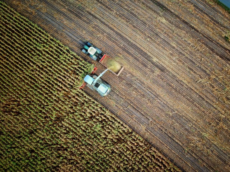
An example of such an application can be seen in Variable Rate Applications, where Copernicus provides the user with a differentiated map highlighting crop health, soil moisture and the normalised vegetation index (NDVI), and with Galileo providing highly accurate positioning data of the machinery that shows where fertiliser and pesticides should be targeted. This enables more efficient use of manpower and reduces the environmental footprint of those activities. Moreover, specific data about precipitation forecasts and evapotranspiration data can be combined with soil moisture and location information in order to create a tool for water management, resulting in a decrease in water usage.
Another gain the agriculture sector has experienced was the partial replacement of on-farm checks with the help of Copernicus and Galileo. The modernised and simplified Common Agricultural Policy (CAP) allowed the “checks by monitoring” approach to rely on satellite data. This does not only simplify and digitise the process, but also results in a more cost-efficient way of checking on farms as it can be inferred from the data where it would be necessary to have people on-site.
These and many other tools have now been compiled into one application, called the FaST digital platform, which provides farmers, Member State Paying Agencies and others with the needed data in order to ensure compliance with the CAP and enable more sustainable and profitable farm management.
Urban Planning
As cities keep growing, urban planning represents a large topic of interest for Europe and Asia. The ratio between the urban and rural population in Asia is currently about 1:1, however, cities are projected to accommodate 66.18% of Asia’s population by 2050. In Europe, 74.88% of the population lives in cities and urban areas, with an expected increase to 83.67% by 2050. Although the 12% increase in European urbanisation trends is already important to consider, it is not even half of the expected 30% growth Asia is expected to experience.
Leveraging Copernicus’ ability to monitor urban growth, green areas as well as land use and its evolution over time, EO can assist in defining and characterising relevant areas for planning and management purposes. Meanwhile, Galileo can be deployed to geo-reference objects and points of interest, understand mobility habits and locate key utilities and infrastructure.
The variety of applications that combine features, like mapping or infrastructure and environmental monitoring, can help public authorities and city planners in creating smart cities and help governments to track compliance with environmental legislation.
LiveEO, for instance, is a German start-up that helps companies in the electricity, railway and pipeline domains in monitoring their infrastructure grids. More specifically, LiveEO observes vegetation along railway tracks or detects 3rd party activities and ground deformation close to the customer’s property, which enables a decrease of damage risk. With the help of similar services, infrastructure networks in cities and rural areas can be maintained more easily.

Copernicus is usually engaged to create the basic layer of maps, while Galileo is used to create the additional layers and geo-referencing points of interest. With this combination, local authorities could map things like park benches, street signs or underground water pipes resulting in an improved infrastructure and utilities monitoring. Maptiler, a product from the Czech start-up OctoGEO, enables visual georeferencing, geodata hosting and other sophisticated mapping features with the help of Copernicus and Galileo.
Another innovative start-up, Sobolt, helps cities in becoming more resilient against the negative effects of climate change and overpopulation. They utilise EO and GNSS data in combination with deep learning to assess the current state of sustainable development and offer tools for future planning as well as trend analysis for things like air quality based on this assessment.
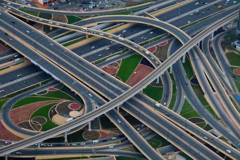
Further important contributions include traffic flow management, which has become a larger issue with an increase in city size. As the mobility habits of citizens can be observed and analysed with the help of combined satellite data, monitoring existing as well as creating new urban corridors has become easier.
Smart Mobility
Speaking of urban corridors, a large area of application that should not go unnoticed is smart mobility. With a globalised world comes the challenge of constantly managing and improving our means of transportation. The reason why satellite data from Galileo and Copernicus is such an integral part is that they aid in detecting and contextualising phenomena that would otherwise be difficult to observe.
In the road domain, mobility and traffic management applications use EO and GNSS satellite data in order to create new mobility policies and safeguard citizen well-being, especially in cities, for example by monitoring the air quality. Additionally, quick situational awareness can be guaranteed within disaster response management activities.
RoadEO, a start-up from the Netherlands, is developing a comprehensive data collection and analytics tool for road quality monitoring and prediction in bot the private and public sector. The mobility start-up leverages data from crowdsourced sensors, as well as EO satellite data, to create a big data pool that can be cross-referenced with GNSS data. The added value from using EO data is that it allows for capturing more frequent, sharper and complex images.
Looking towards the future of smart mobility, the benefits of using Copernicus and Galileo also play a big role. Urban Air Mobility (UAM), for instance, encompasses air passenger and cargo transportation within cities, requires satellite data. Galileo GNSS data will be needed in order to know the vehicles positioning and support the navigation, whilest Copernicus EO data provides the detailed mapping information in order to support the strategic planning of the UAM infrastructure.
Other Application Areas
Another noticeable application area is the maritime domain, in which both technologies can be used to aid with topics like maritime safety, law enforcement, border surveillance, or fishery and living marine resource protection. The Sara project utilises Galileo and Copernicus data in order to locate seafarers and passengers in distress after a wreck.
Additionally, environmental management can be supported through GNSS and Copernicus usage, by enabling in-depth monitoring and facilitating interventions in the most problematic areas. Several start-ups have developed forest fire detection applications based on EO and GNSS and complimentary to this, drone services that distribute seeds in the damaged areas in order to help reforestation. Copernicus data can be used to determine which areas are ready receive the tree seeds while Galileo enables the exact navigation of the autonomous drones.
How to enable the creation of more applications?
What has become apparent during this article, is the fact that the application possibilities of this dynamic duo are endless and represent growth. Therefore, the logical conclusion must be to continue to support the development of applications and create bridges between Copernicus and Galileo users around the world.
In order to foster the development of new solutions that harvest the synergies from Galileo and Copernicus, the European Commission is organising several innovation competitions like for example the Copernicus Masters Challenge, where this year’s focus lies on smart mobility applications. All of those programmes will be combined into the CASSINI programme.
If you want to find out more about synergies between Copernicus and Galileo do not hesitate to get in touch with the GNSS.asia team at hello@gnss.asia, or subscribe to our newsletter to stay up to date on the latest trends and developments.